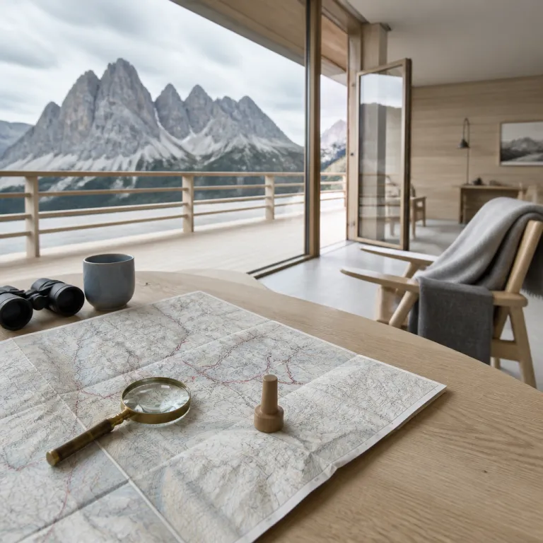
How to Read a Dolomites Map for a Seamless Luxury Stay
Reading a Dolomites map for luxury‑minded travellers
A detailed Dolomites map is the quiet secret behind a seamless luxury stay in northeastern Italy. When you understand how the valleys, passes, and elevations relate, you can match five star hotels with the most spectacular mountain scenery and realistic transfer times. This is how discerning guests turn a beautiful trip into the best version of an Alpine escape.
The Dolomites form a dramatic mountain range spread across Veneto, Trentino Alto Adige and South Tyrol, and Friuli Venezia Giulia. On any good map of the Dolomites, you will see the main valley systems, each labelled as a val or valley, with road numbers, cable cars, and rifugio locations clearly marked. That cartographic clarity lets you judge driving time between luxury hotels and signature hiking areas with precision, instead of relying on vague distance estimates.
Look for a Dolomites map that shows contour lines and elevation shading, because altitude shapes both climate and comfort. A hotel at 1 200 metres in a sheltered valley feels very different from a rifugio at 2 400 metres near a high pass. When you compare elevations, you can decide whether you prefer gentle valley strolls or direct access to serious mountain trails, and whether you want your spa and pool at lower or higher altitude.
The Dolomites are recognised as a UNESCO World Heritage site for their pale limestone towers and unique geology. On many printed and digital maps, the heritage site boundary is outlined, helping you understand which hotels sit inside the most protected landscapes. That awareness matters when you care about both refined hospitality and environmental responsibility, because you can favour properties that work closely with park authorities and local guides.
Official tourism boards in Veneto, Trentino Alto Adige and South Tyrol have invested in the development of detailed regional maps. These resources highlight hiking routes, ski areas, and mountain huts, and they often indicate which valleys are most suitable for families or for expert alpinists. When you combine those maps with curated hotel collections or recommendations from specialist concierges, you gain a powerful planning tool for a tailored stay.

Using a Dolomites map to choose the right valley and resort
Every Dolomites map tells a story of valleys, passes, and lakes, and that story should guide your hotel choice. Start by identifying the major valleys such as Val Gardena, Val Badia, Val Funes, Val Fassa, and the Ampezzo valley around Cortina d’Ampezzo. Each val has its own character, and the best luxury hotels lean into those differences rather than smoothing them out.
Val Gardena, in South Tyrol, is ideal if you want a balance of high end hotels, efficient lifts, and varied hiking. On a Dolomites map, you will see Ortisei, Santa Cristina, and Selva Gardena strung along the valley floor beneath dramatic mountain walls. From these bases, you can reach Alpe di Siusi, the vast high pasture also written as Alpe Siusi, which appears on maps as a broad plateau with gentle trail networks; a private transfer from Bolzano Airport typically takes around one hour to Ortisei, depending on traffic.
Val Badia and Alta Badia, centred on villages like Corvara and La Villa, appear on the map as a branching valley system beneath the Sella massif. Here, many five star hotels sit almost ski in ski out, with lifts rising directly from the valley to high elevation passes. In summer, the same lifts connect you to panoramic hiking routes and traditional rifugi, making it easy to pair spa time with mountain air and long lunches on sunny terraces.
To the north, Val Funes is a narrower valley that you will spot on a Dolomites map by the iconic church of Santa Maddalena beneath the Odle peaks. Accommodation here is more intimate, but you still find refined chalets and small luxury hotels with direct access to quiet trailheads. This is a strong choice if you value tranquillity and photography over nightlife, and if you prefer short drives to sunrise or sunset viewpoints.
Eastwards, the Ampezzo valley around Cortina d’Ampezzo and the town of Cortina itself forms a broad basin ringed by peaks like Croda da Lago and the Tofane. When you study the map, note how roads and passes radiate from Cortina, making it a strategic base for day trips to Tre Cime di Lavaredo, Lago di Misurina, and Cadini di Misurina. For curated ideas on how to pair high end hotels with refined experiences here, many travellers consult guides to luxurious stays in Cortina and then cross check locations on their Dolomites map.
Passes, travel time, and arrival logistics on your Dolomites map
Once you have chosen your preferred valley, a Dolomites map becomes your main tool for understanding travel time and access. The mountain passes that link each val are beautiful, but they also dictate how long it takes to reach your hotel from major airports. Reading those passes correctly helps you avoid long transfers after a flight and choose whether to arrive by private car, helicopter, or a combination of both.
Key passes such as Passo Gardena, Passo Sella, Passo Falzarego, and Passo Giau are clearly marked on any detailed Dolomites map. Each pass connects two valleys, for example Passo Gardena links Val Gardena with Val Badia and Alta Badia, while Passo Falzarego connects Cortina d’Ampezzo with the Agordo and Belluno areas. When you trace these routes, you can see whether your chosen hotel requires multiple passes or a more direct valley road; Venice to Cortina, for instance, usually takes about two hours by road in good conditions.
Elevation profiles on a Dolomites map also matter for comfort, especially if you are arriving from sea level. A transfer that climbs quickly from the Veneto plains near Belluno to a high pass can feel more tiring than a gradual ascent through a long valley. If you are travelling with children or older guests, consider a hotel in a lower elevation town such as Ortisei, San Martino di Castrozza, or Dobbiaco, where you still enjoy mountain views without sleeping at extreme altitude.
San Martino di Castrozza, often shortened on maps to Martino Castrozza, sits beneath the Pale di San Martino group in the southern Dolomites. When you look at a regional map of this area, you will see how the road from Feltre and the Veneto lowlands climbs steadily into the valley without crossing multiple high passes. That makes it a practical choice for a first stay in Italy’s Dolomites if you prefer shorter transfer times and a straightforward route for a private driver.
Many luxury travellers combine a Dolomites stay with other Alpine resorts, so it helps to compare transfer options in advance. Resources that explain refined ways to reach major ski resorts, such as guides on travelling from Geneva Airport to top Alpine destinations, can inspire similar strategies for reaching your chosen Dolomites hotels; for example, you might adapt ideas from elegant transfer solutions to La Plagne. Once you understand the pattern of passes and valleys on your Dolomites map, you can brief a private driver or helicopter operator with confidence.
Typical private transfer times (good conditions, approximate):
| Airport | Key Dolomites town | Typical drive time |
|---|---|---|
| Venice (VCE) | Cortina d’Ampezzo | ~2 hours |
| Bolzano (BZO) | Ortisei (Val Gardena) | ~1 hour |
| Innsbruck (INN) | Dobbiaco / Toblach | ~2 hours |
Iconic peaks and lakes on the Dolomites map for hotel planners
For many guests, the choice of hotel in the Dolomites starts with a single image on a map, often a peak or a lake. When you know where those icons sit in relation to each val, you can select hotels that minimise travel time to your personal highlights. A Dolomites map turns those dreams into a practical itinerary, especially when you match symbols on the map with realistic driving times.
The Tre Cime di Lavaredo, also known as Cime di Lavaredo, appear on maps as three distinct towers on the border between South Tyrol and the province of Belluno. Access usually starts from the road above Lago di Misurina, near the Cadini di Misurina group, both of which you will find clearly labelled on a good Dolomites map. Staying in hotels in Dobbiaco, Sesto, or Cortina d’Ampezzo keeps driving time to the Tre Cime trailhead pleasantly short, often between 45 and 75 minutes depending on your base.
Lago di Braies, another favourite, lies in a side valley north of the main Puster valley, and its position is easy to spot on any regional map. Because the road to Lago Braies can be restricted in peak season, it is wise to choose hotels in nearby villages like Monguelfo or Villabassa, which appear as small dots along the main valley road. A Dolomites map that shows parking areas and shuttle routes helps you plan early morning visits before the crowds arrive and still be back at your hotel in time for a late breakfast.
Alpe di Siusi, or Alpe Siusi, is the largest high altitude meadow in Europe and occupies a broad plateau above Val Gardena and the Isarco valley. On a Dolomites map, the plateau looks almost like an island of gentle contours surrounded by steep mountain walls, with cable car lines rising from Ortisei and Siusi allo Sciliar. Choosing hotels in these base villages gives you quick access to the plateau’s easy hiking trails and panoramic viewpoints, ideal for relaxed walks before afternoon spa sessions.
Further south, the Pale di San Martino group towers above San Martino di Castrozza, and its jagged skyline is clearly marked on topographic maps. Here, a Dolomites map will show rifugi and mountain huts scattered along the main ridges, connected by a network of hiking trails. Guests who stay in high end hotels in San Martino can use these maps to plan day hikes that end with aperitivo back at the spa by late afternoon, after a short transfer from the trailhead.
Download a sample GPX file for a classic Dolomites valley-to-rifugio route
Hiking trails, rifugi, and mountain huts through a luxury lens
A Dolomites map is not only about roads and hotels; it is also your gateway to the region’s hiking culture. The network of trails, rifugi, and mountain huts is dense, and understanding it allows you to design excursions that match your fitness and comfort expectations. Luxury travellers can enjoy this world without sacrificing refinement, especially when they use detailed hiking maps rather than generic road overviews.
On most hiking maps of the Dolomites, trails are graded by colour and number, with clear indications of elevation gain and estimated time. For example, a loop around Croda da Lago near Cortina d’Ampezzo might show 400 metres of ascent and a walking time of three to four hours, which is ideal for a half day outing from a nearby five star hotel. When you read these details, you can schedule spa treatments or fine dining reservations without stress, knowing exactly when you are likely to return.
Rifugi, the traditional mountain huts of Italy, appear on a Dolomites map as small icons often accompanied by names and elevations. Some rifugi are simple shelters, while others offer surprisingly refined cuisine and well curated wine lists, making them attractive lunch stops for guests staying in luxury hotels down in the valley. Planning a hike from your hotel to a rifugio and back, using the map to track distance and elevation, creates a satisfying yet comfortable adventure.
Areas such as Alta Badia, Val Gardena, and Val Fassa are particularly well served by lifts that connect valley hotels with high altitude trail networks. On a Dolomites map, you will see these lifts as straight lines rising from villages like Corvara, Selva, and Canazei to passes on the Sella and surrounding massifs. This infrastructure allows you to enjoy panoramic hiking without committing to long, steep ascents from the valley floor, which is especially appealing if you prefer to conserve energy for evening dining.
Some guests choose to spend a night in a rifugio or mountain hut as a contrast to their main luxury base. In that case, a Dolomites map helps you identify which huts are closest to your hotel and which trails offer the most scenic yet manageable approach. By combining one or two nights in mountain huts with several nights in high end hotels, you experience both the raw mountain environment and the comfort of spa level relaxation.
Seasonality, timing, and reading the Dolomites map by month
Seasonality changes how you should read a Dolomites map, because access, trail conditions, and hotel operations all shift through the year. In summer, most passes are open, hiking trails are clear of snow, and rifugi operate at full capacity. Winter brings a different rhythm, with ski areas dominating and some high roads closing, which you will see clearly marked on updated regional maps.
When planning a summer stay, use your Dolomites map to check which passes are likely to be open during your travel time. Passes such as Passo Giau, Passo Pordoi, and Passo Sella usually open once snow has melted sufficiently, linking valleys like Val Badia, Val Gardena, and the Fassa valley. If a pass is closed, you may need to reroute through lower elevation roads in the Veneto plains or the Puster valley, which can add significant time to your transfer and may influence which village you choose as a base.
In winter, focus on how ski areas connect across the map, especially if you are interested in the Dolomiti Superski circuit. Resorts such as Alta Badia, Val Gardena, and Cortina d’Ampezzo appear as clusters of lifts and pistes, and your Dolomites map will show which hotels sit closest to main gondolas. Choosing a hotel near a primary lift station reduces walking in ski boots and maximises your time on the mountain, particularly if you plan to ski the Sella Ronda circuit in a single day.
Shoulder seasons can be particularly rewarding for luxury travellers who value quiet trails and attentive service. Many insiders appreciate the advantages of travelling in the less crowded months, and resources that explain why the Alpine shoulder season is an insider’s secret, such as analyses of September stays in the Alps, apply equally well to the Dolomites. When you cross reference such advice with your Dolomites map, you can identify valleys where hotels remain open while crowds thin and passes are still accessible.
Whatever the season, always check local information from tourism offices in Belluno, Bolzano, and Trento, which often publish updated maps and notices. Their data on trail closures, rifugio opening dates, and roadworks can change how you interpret your Dolomites map in practice. That combination of official updates and careful map reading is the hallmark of a well planned, high end Alpine journey.
Heritage, regions, and responsible luxury through the Dolomites map
A Dolomites map is also a cultural document, showing how language, history, and heritage intersect across this mountain range. The region spans South Tyrol, Trentino, and Veneto, and place names on the map often appear in both Italian and German. Understanding these nuances helps you choose hotels that align with your interests in food, architecture, and local traditions, whether you favour Tyrolean chalets or Italianate villas.
In South Tyrol, towns like San Candido, Brunico, and the area around Plan de Corones, also written as Plan Corones, reflect a blend of Alpine and Mediterranean influences. On your Dolomites map, you will see how these towns sit along the Puster valley, with side valleys leading to Lago di Braies, Tre Cime, and other highlights. Luxury hotels here often emphasise wellness, with extensive spa facilities that pair well with day trips into the surrounding mountains.
Further south in Veneto, the province of Belluno includes areas such as Cortina d’Ampezzo, the Cadore valleys, and the approaches to Tre Cime di Lavaredo from the south. A Dolomites map of this region highlights the road network that climbs from the Piave valley into higher elevation basins, where hotels range from historic grand properties to contemporary design led retreats. Choosing between South Tyrol and Belluno often comes down to whether you prefer German influenced or Italian accented hospitality.
The UNESCO World Heritage site designation for the Dolomites underlines the responsibility that both travellers and hotels share in preserving this landscape. Maps that mark the heritage site boundaries and protected zones make it easier to understand where development is limited and where traditional land use continues. When you select hotels that support local conservation initiatives and use maps to stay on designated trails, you contribute to the long term health of the region.
Local tourism boards and travel agencies have collaborated on the development of detailed regional maps to promote sustainable hiking, skiing, and climbing. These maps encourage visitors to spread out across different valleys, from Val Funes and Santa Maddalena to Val Fassa and Alta Badia, reducing pressure on a few famous spots. By reading your Dolomites map with this broader perspective, you can design an itinerary that feels exclusive yet remains respectful of the mountains that make this part of Italy so special.
Key figures and mapping facts for Dolomites trip planning
- The Dolomites cover an area of about 15 942 km², so a detailed Dolomites map is essential for understanding distances between valleys and planning realistic day trips (source: UNESCO World Heritage Centre – The Dolomites, area data).
- The highest peak in the Dolomites is Marmolada at 3 343 metres of elevation, which helps travellers gauge altitude differences between valley hotels and high mountain viewpoints (source: Peakbagger – Marmolada, elevation data).
- The Dolomites were designated a UNESCO World Heritage site in 2009, and many modern maps now mark the heritage site boundaries to guide responsible tourism (source: UNESCO World Heritage Centre – The Dolomites, inscription year).
- Official regional maps from tourism boards in Veneto, Trentino Alto Adige and South Tyrol typically highlight hundreds of marked hiking trails, reflecting the region’s focus on structured, safe mountain access for visitors (source: regional tourism offices and their published cartography).
- Key valleys such as Val Gardena, Val Badia, Val Funes, Val Fassa, and the Ampezzo valley around Cortina d’Ampezzo sit between roughly 1 000 and 1 600 metres of elevation, a range that offers comfortable sleeping altitudes for most guests while keeping high mountain terrain accessible by lifts (source: regional topographic maps and official altitude data).
FAQ about Dolomites maps and luxury hotel stays
What are the Dolomites and where are they located ?
The Dolomites are a mountain range in northeastern Italy, known for pale limestone cliffs and dramatic spires. They extend across the regions of Veneto, Trentino Alto Adige and South Tyrol, and Friuli Venezia Giulia, with coordinates centred around 46.4333° N and 11.8500° E. A Dolomites map will usually show this broader regional context, helping you understand access from airports like Venice, Verona, and Innsbruck.
Why is a Dolomites map important when booking luxury hotels ?
A Dolomites map shows how valleys, passes, and elevations relate, which directly affects transfer times and daily excursion options. By studying the map, you can choose hotels in valleys such as Val Gardena, Alta Badia, or Cortina d’Ampezzo that minimise driving to key sights like Tre Cime di Lavaredo or Lago di Braies. This planning ensures that your stay feels relaxed and efficient rather than dominated by long journeys.
Which activities can I plan using a Dolomites map ?
With a detailed Dolomites map, you can plan hiking, skiing, climbing, and scenic drives across multiple valleys. Hiking maps highlight trails, rifugi, and mountain huts, while winter maps show ski lifts and pistes in areas like Plan de Corones, Val Fassa, and Alta Badia. Combining these maps with hotel locations allows you to match daily activities to your preferred level of effort and comfort.
How does the UNESCO World Heritage status appear on maps ?
Many modern Dolomites maps mark the UNESCO World Heritage site boundaries with shaded areas or distinct outlines. These markings help travellers see which peaks, valleys, and lakes fall within the protected zones, such as parts of the Tre Cime area or the Pale di San Martino group. When booking hotels and planning hikes, this information supports more responsible choices that respect conservation priorities.
When is the best time to use a Dolomites map for trip planning ?
You should start working with a Dolomites map several months before your trip, especially if you are targeting peak summer or winter dates. Early map study helps you understand seasonal road openings, lift operations, and the relationship between your chosen hotel and nearby highlights. As your travel time approaches, you can then refine your plans with updated local information on trail conditions and roadworks.